Lake Shannon's Deep Water Structure
Photo's from 70's era dam breach
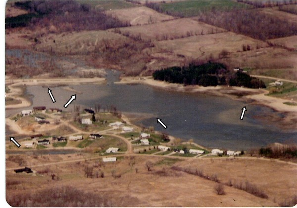
Spillway humps & Dean Road
In the above picture the two upper arrows point out the humps by the spillway and the three lower arrows show the path of the old Dean Road
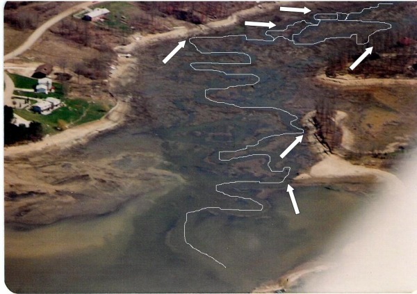
Path of Ore Creek & Swim Beach Structure
In the photo above the white line traces the path of Ore Creek, the arrows indicate places where the deep water of the creek bed intersects with the shore or (in the case of the lowest arrow) the under water point off the swim beach.
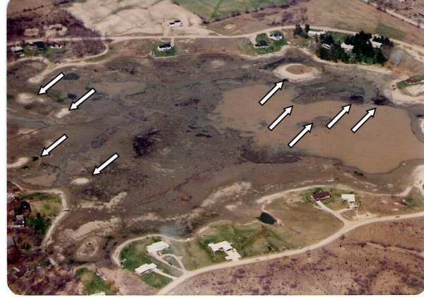
Northwest Structure
In the photo above the two lower arrows on the left point to the stumps and the submerged rock wall, the two upper arrows on the left show two under water humps. The arrows on the right show the humps and other structure around the lighthouse and Dublin Island.
Back to Largemouth Bass Back to Fishing Deep Water Structure
